This Week in Israel’s History: Britain and France Divide Middle East Territories » sykes-picot agreement map
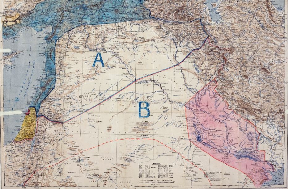
The original map of the Sykes-Picot Agreement. The area labeled with the letter “A” was to be under French influence; the area marked with the letter “B” was to be under British influence. The blue area was to be under direct French control while the red area, including the port of Haifa, was to be under direct British control. The area in yellow, which included some of present day Israel, was to be an International Zone. (Wikipedia)
Image metadata
Date Taken: 19-May-2016 11:11:12Credit: user
Shutter Speed: 0 seconds
